Exploring Antigua’s Cultural Heritage and Biodiversity Treasures

Antigua, with its beautiful coastline and vibrant culture, offers much more than meets the eye. The island’s perimeter spans roughly 87 km (54 mi), encompassing an area of 281 km² (108 sq mi). As of the 2011 Census, Antigua is home to 83,191 residents, with the economy predominantly driven by tourism and supported by a domestic agricultural sector. The capital city, St. John’s, located in the northwest, houses over 22,000 people. St. John’s boasts a deep harbour capable of accommodating large cruise ships, making it a key entry point for visitors. Other significant settlements include All Saints, with a population of 3,412, and Liberta, home to 2,239 residents, according to the 2001 census. On the southeastern coast, English Harbour stands out as one of the largest deep-water, protected harbors in the Eastern Caribbean. This historic site is home to Nelson’s Dockyard, a UNESCO World Heritage Site. The dockyard is a restored British colonial naval station named after Vice-Admiral Horatio Nelson. English Harbour, along with the neighbouring village of Falmouth, serves as a major yachting and sailing destination and provisioning centre.
Antigua’s love for sailing is showcased during the annual Antigua Sailing Week, held at the end of April and beginning of May. This renowned regatta attracts numerous sailing vessels and sailors from around the globe, eager to participate in various sporting events. Additionally, every December for the past 60 years, Antigua has hosted one of the largest charter yacht shows, welcoming super-yachts from around the world. Antigua’s blend of rich history, strategic harbors, and vibrant sailing culture makes it a unique destination for tourists and sailors alike. Whether exploring the capital city, marvelling at historic sites, or participating in world-class sailing events, visitors to Antigua are sure to experience an island that seamlessly merges the past with the present.
Exploring Antigua’s Beautiful Cultural, Heritage, and Biodiversity Spots
Greetings! I recently had the honor of participating in the United Nations’ fourth session of the Small Island Developing States (SIDS) Meeting in Antigua.
I serve as the Regional Programme Coordinator for Protected and Conserved Areas in Oceania within the International Union for Conservation of Nature (IUCN). With over 15 years of experience in biodiversity conservation, planning, and policy and project implementation, I have dedicated my career to advancing sustainable development in both governmental and non-governmental sectors at regional and national levels. My primary focus is on effectively implementing biodiversity strategies and action plans to foster environmental resilience. My professional journey has taken me across the globe, allowing me to collaborate with diverse communities, policymakers, and international organizations. In addition to my work, I have a profound love for travel and cultural exploration, which has enriched my understanding of the interconnectedness of global communities and the importance of addressing climate change and other global crises. Join me as I share my experiences from the SIDS4 Conference, insights into sustainable development, and stories from my travels. Together, we can chart a course toward a more resilient and prosperous future for small island developing states and beyond.
Discovering Shirley Heights: Antigua’s Historical Gem
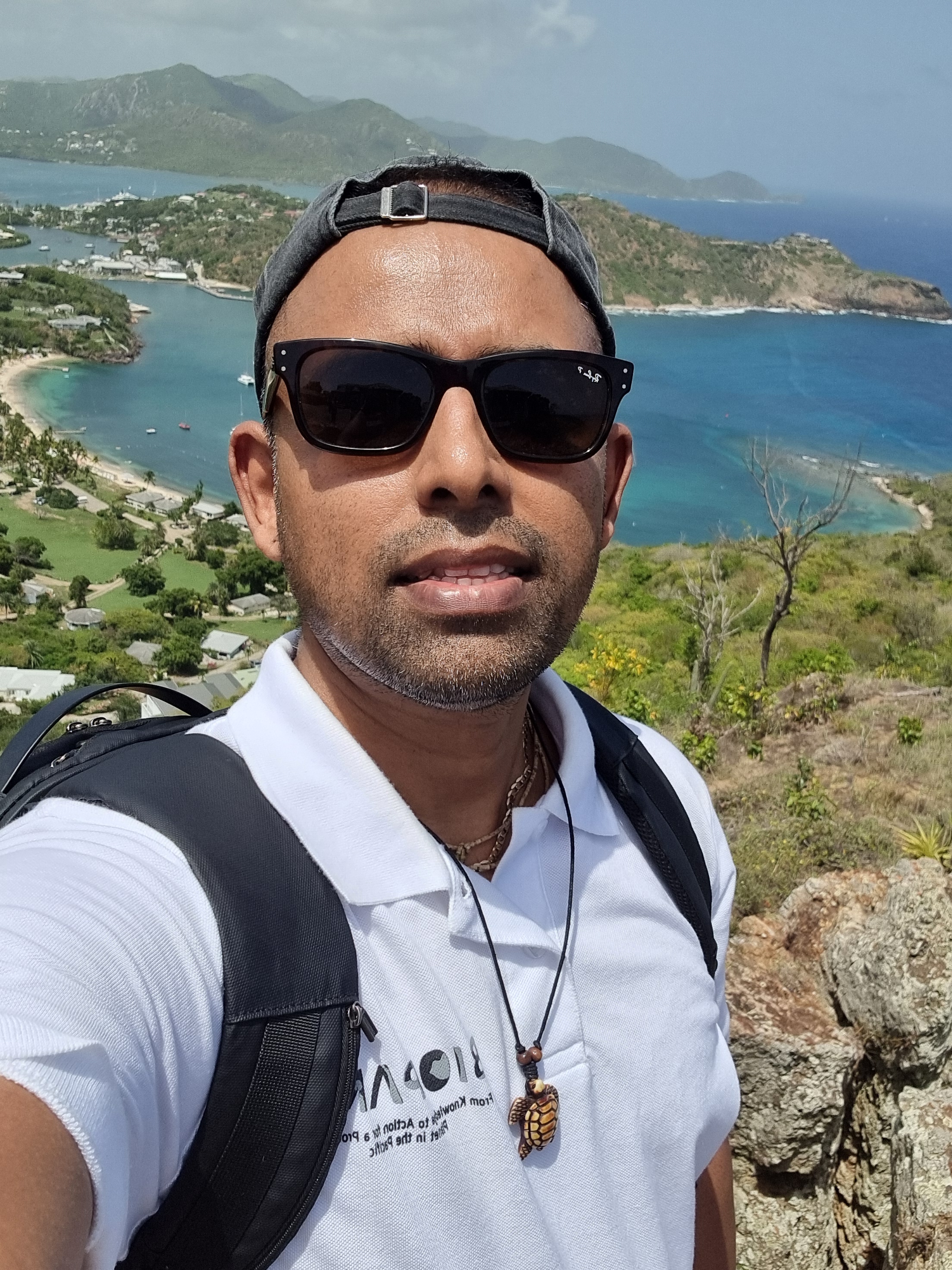
During my recent trip to Antigua, I had the pleasure of visiting Shirley Heights, a restored military lookout and gun battery with a rich history and breath-taking views. Standing at about 490 feet above sea level, Shirley Heights offers what is undoubtedly the best view in Antigua, overlooking English and Falmouth Harbours. The scenery is especially spectacular at sunset and early evening when the entire English Harbour lights up, creating a mesmerizing panorama.

Shirley Heights played a crucial role during the War of American Independence (1774-1783) as a signal station and lookout for approaches to English Harbour. With French Guadeloupe directly to the south, this strategic location was perfect for keeping Antigua’s coastline safe. During the day, sentries could spot approaching sails and raise an alarm using flags, while at night, they used signal guns. This system was so effective that the entire island could be on alert within 10 minutes of the first signal, making it one of the best in the Caribbean. As the garrison along the Ridge expanded, additional barracks for soldiers, water cisterns, and gun platforms were constructed to ensure the safety of the Dockyard below. Exploring this historic site, I felt transported back in time, imagining the soldiers who once stood guard here.
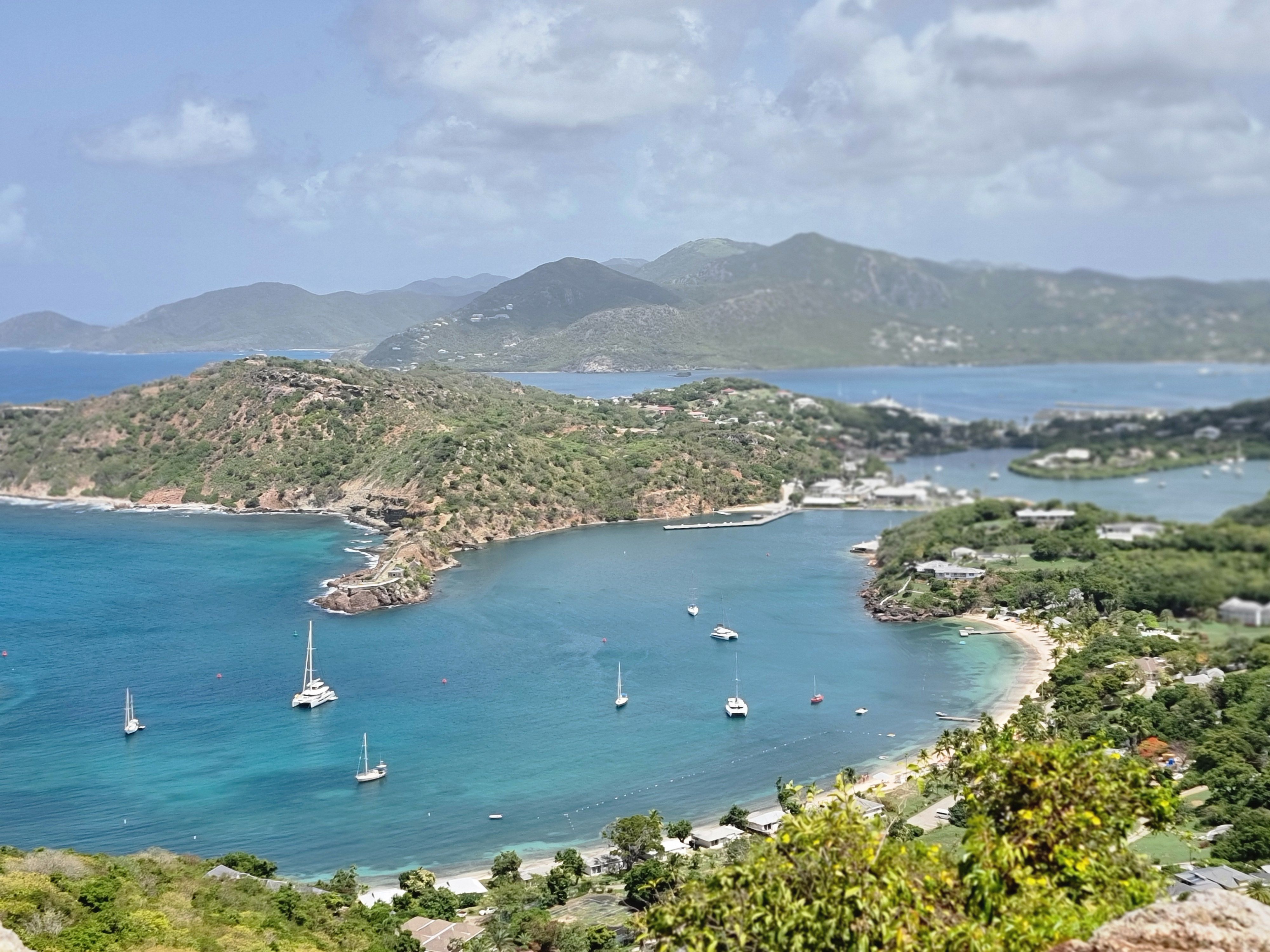

Beyond its historical significance, Shirley Heights offers more than just a glimpse into the past. The panoramic views are truly awe-inspiring, stretching across the beautiful ocean and lush green tropical forests, reminiscent of the Tropical and Subtropical Savannahs and Grasslands. The cool breezes and vibrant surroundings create a serene and picturesque environment. As I wandered around, I discovered charming local vendors selling beautiful handcrafted gifts. It was a joy to browse through their offerings, each piece reflecting the island’s rich culture and craftsmanship. The combination of stunning natural beauty, historical intrigue, and local artistry made my visit to Shirley Heights an unforgettable experience.
If you ever find yourself in Antigua, a trip to Shirley Heights is a must. Whether you’re a history enthusiast, a nature lover, or simply in search of a breath-taking view, this iconic spot has something for everyone.
Exploring the Blockhouse: Antigua’s Historic Lookout
After my visit to Shirley Heights, I made my way to the Blockhouse, a site that perfectly blends rugged coastline views with captivating historical ruins. The Blockhouse is where British soldiers once monitored the southern Atlantic and Caribbean approaches to English Harbour. On clear days, the sight of French Guadeloupe framed against the southern horizon is breath-taking. If you’re lucky enough to visit during the spring whale migrations, you might even catch a glimpse of Humpback whales breaching just off the coast.
The Blockhouse itself is a small fort and garrison complex perched on the headland. The British military once enjoyed an unobstructed view of Antigua’s west coast from here, stretching from Indian Creek past Willoughby Bay. This strategic vantage point meant that the soldiers stationed at the Blockhouse were the island’s first line of defense against any potential French landings. Constructed in 1789, the garrison complex was continuously occupied until 1854 when the last British regiment left the island. Exploring the ruins, I could see the remnants of the Officers’ Quarters, the central cistern, and the Enlisted Men’s Barracks. Behind these main buildings lay more ruins of kitchens, offices, storerooms, stables, and married quarters, each telling a story of the lives once lived here.
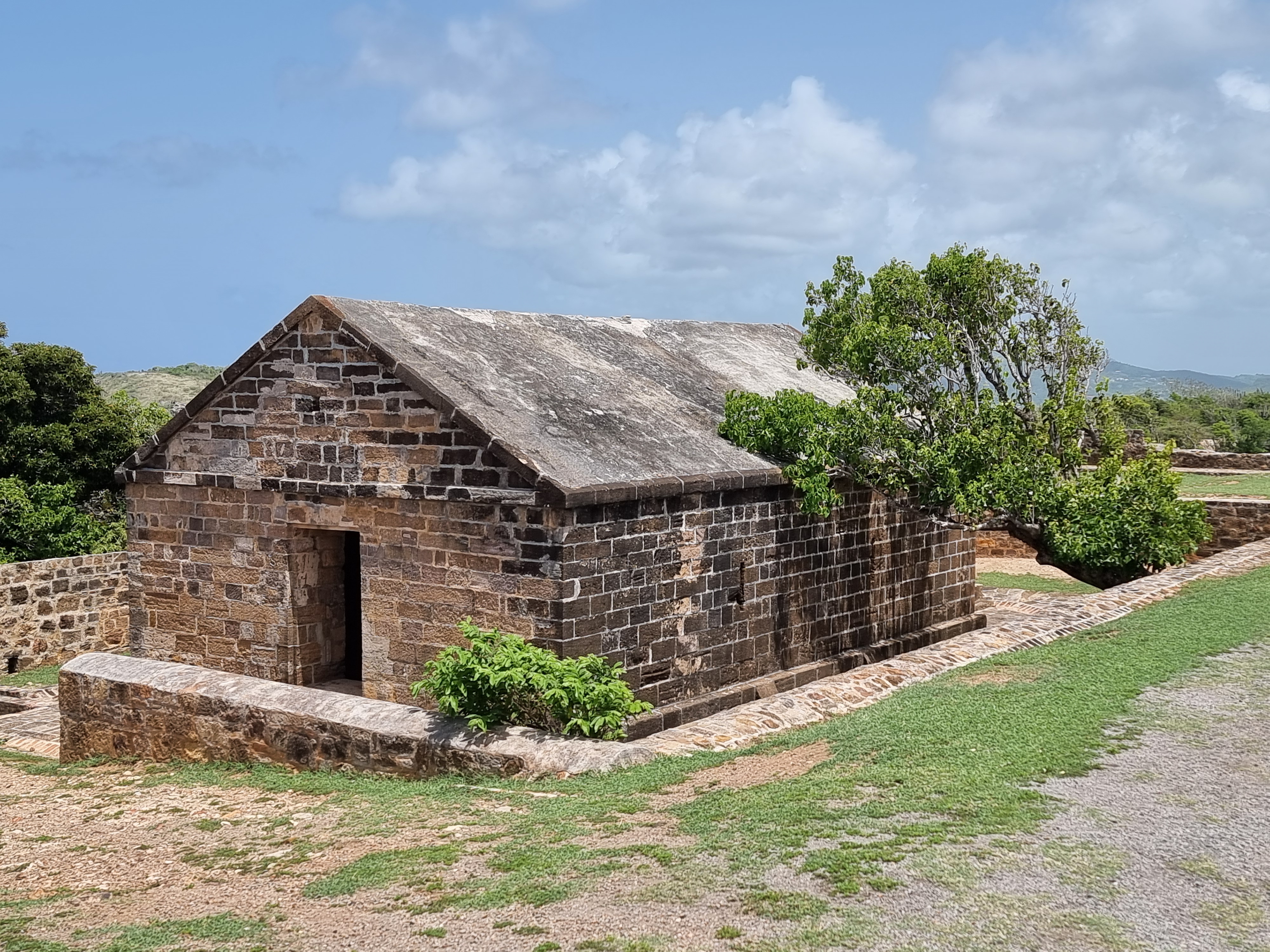
Today, the Blockhouse is a popular spot for watching sunsets and moon rises, offering some of the most stunning views on the island. It’s also the site of the weekly “Rum in the Ruins” event, where visitors can enjoy a taste of local culture amidst the historic backdrop. For those who enjoy hiking, the Blockhouse Loop trail starts and finishes within these ancient ruins, making it a perfect blend of nature and history. My visit to the Blockhouse was truly memorable. The combination of dramatic coastal scenery, rich historical context, and the chance to engage with local traditions made it an enriching experience. If you find yourself in Antigua, the Blockhouse is a must-visit for anyone who loves history, nature, and a bit of adventure.

Exploring the Historic Beauty of Nelson’s Dockyard in Antigua
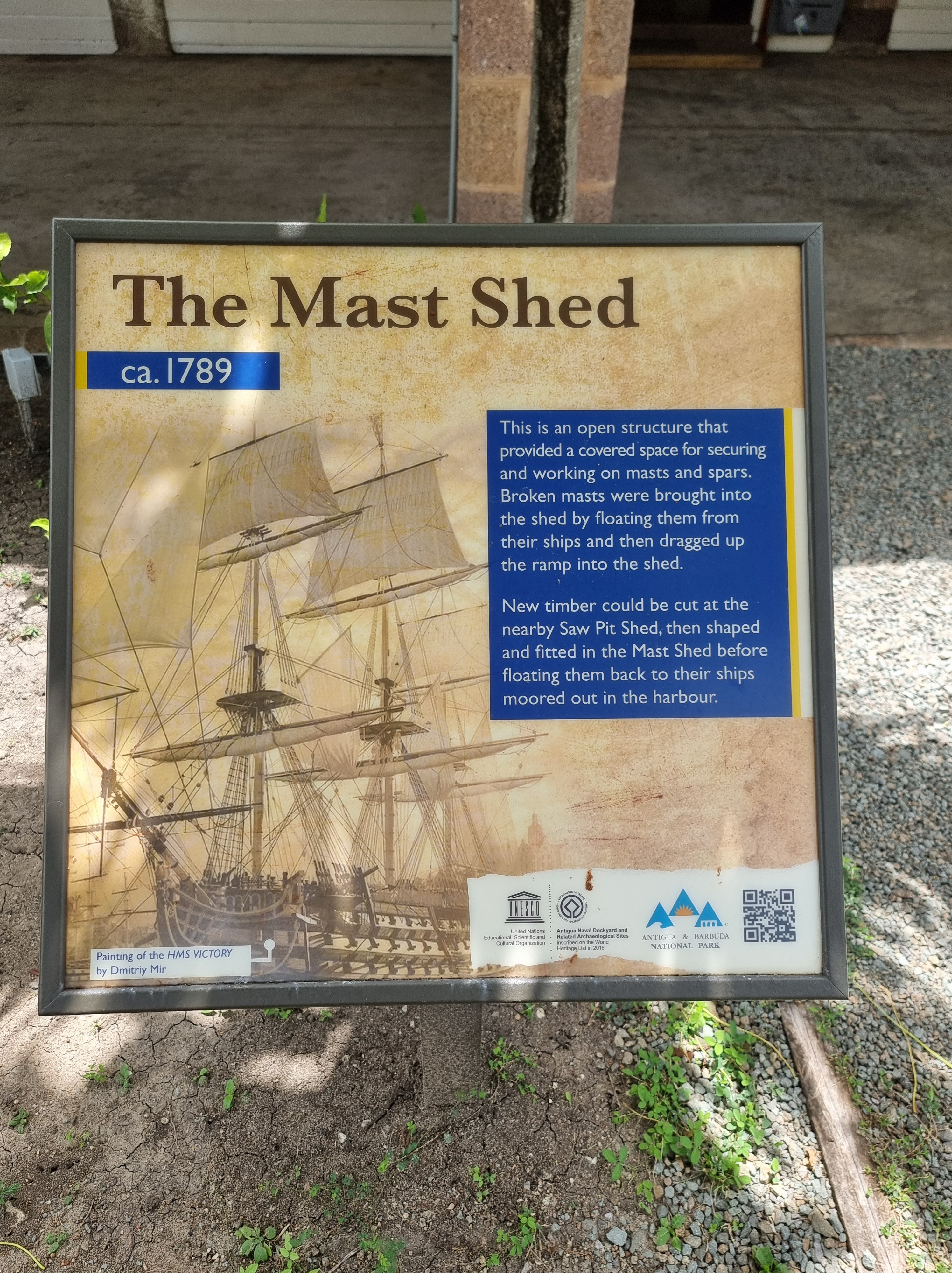
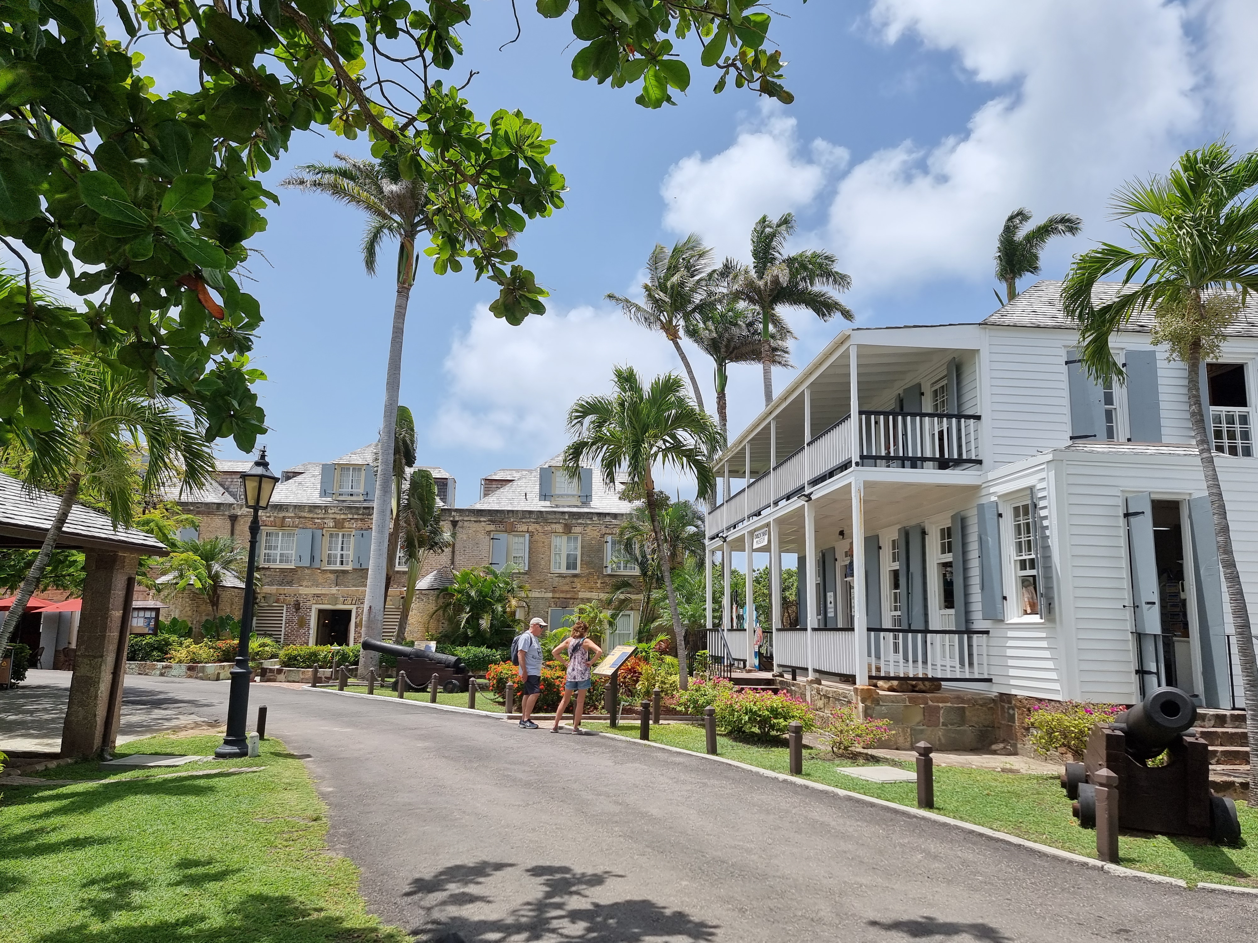
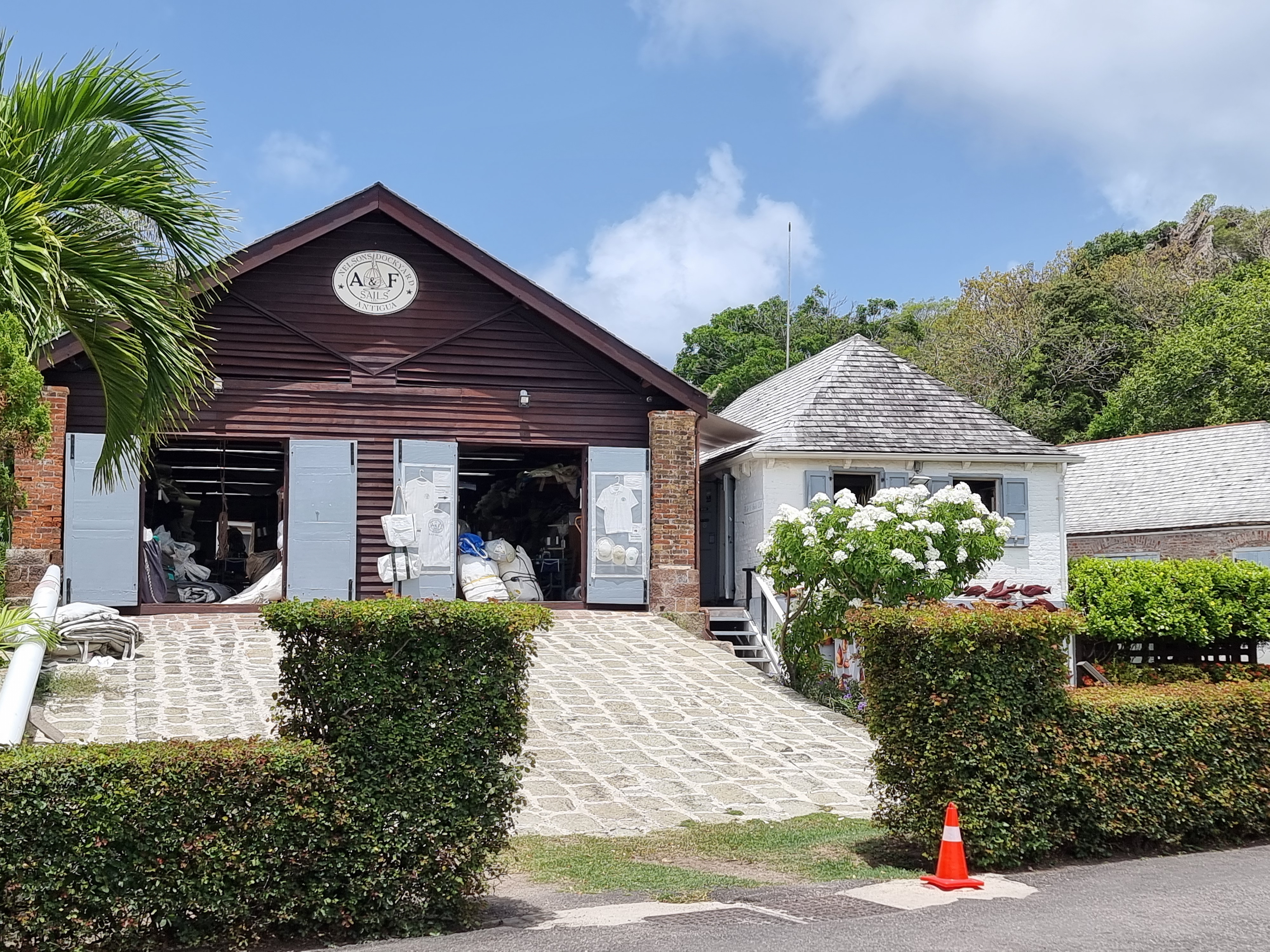
On a sun-drenched morning, I found myself stepping into the historic realm of Nelson’s Dockyard in Antigua, a place where history whispers through the creaking wooden docks and ancient stone buildings. This remarkable heritage site, once known as “His Majesty’s Yard in English Harbour” or the “Antigua Naval Dockyard,” offered me a journey through time, tracing the footsteps of the Royal Navy and its most famous officer, Horatio Nelson. The Dockyard’s history is deeply intertwined with the strategic naval endeavours of the British Crown. In 1725, local sugar planters offered the harbour to the British Crown, hoping for military protection in return. However, the Royal Navy initially showed little interest, using the harbour sporadically until the 1740s. The French privateer threat during this period prompted the British to establish a more permanent naval presence, leading to the construction of the Antigua Naval Dockyard. A particularly striking part of the Dockyard’s history is its reliance on the labour of enslaved Africans, who were the backbone of the construction and maintenance efforts. These individuals, often forced into backbreaking work, were essential in building the infrastructure that supported the Royal Navy’s operations in the Caribbean.
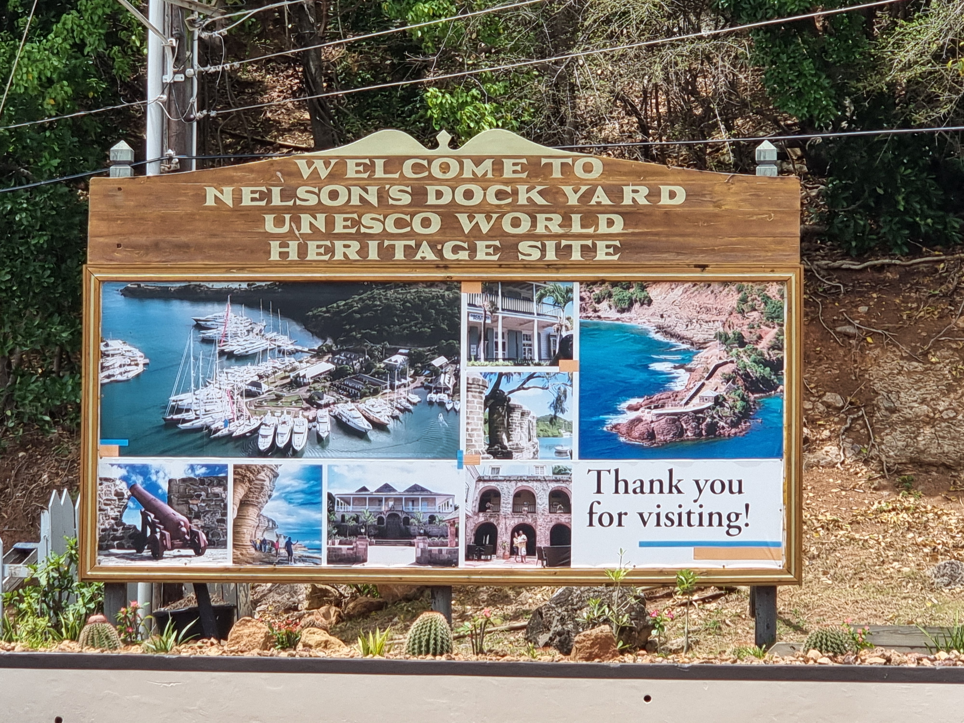
Between 1784 and 1787, Horatio Nelson, a young Royal Navy Captain, was stationed at English Harbour. Ironically, despite the Dockyard now bearing his name, Nelson despised his time here, famously describing the place as an “infernal hole.” His strict enforcement of the Navigation Acts to prevent smuggling earned him the animosity of local plantation owners, illustrating the tense relationship between the Navy and the local populace. After the defeat of Napoleon and the advent of new naval technologies, the importance of Nelson’s Dockyard waned, leading to its closure in 1889. The Dockyard fell into ruin until interest in its restoration emerged in the 1920s. Despite early setbacks, a rebranding campaign in the 1930s renamed it Nelson’s Dockyard, and by 1961, it was reopened as a historic site. In 1984, the creation of the Nelson’s Dockyard National Park solidified its status as a protected heritage site, culminating in UNESCO recognizing it as a World Heritage Site in 2016.
The scorching heat was my first welcome to Nelson’s Dockyard, the sun blazing down as I navigated the historical expanse. Despite the warmth, the pristine and beautiful ocean view provided a stunning backdrop, its calmness a stark contrast to the bustling naval history that once defined this place. Walking through the Dockyard, I found charming gift shops boasting local handicrafts. These shops were a treasure trove of unique souvenirs, each piece a testament to Antigua’s vibrant culture and craftsmanship. Lunchtime offered a delightful respite, allowing me to enjoy a meal in the serene surroundings. The calm ambiance, coupled with the lush greenery, made for a perfect setting to relax and soak in the historical atmosphere. A local tour guide, brimming with Antiguan humour, brought the Dockyard’s history to life with engaging anecdotes and insightful commentary. His stories painted vivid pictures of the past, making the historical facts resonate on a personal level. However, my encounter with nocturnal mosquitoes was less pleasant. These tiny assailants seemed to have developed a fondness for me, attacking relentlessly. Despite this, the overall experience remained enchanting. Nelson’s Dockyard is more than just a historic site; it’s a testament to the resilience and evolution of a place that played a pivotal role in Caribbean history. My visit was a blend of historical enlightenment, natural beauty, and cultural richness. For anyone interested in history, or simply looking to experience a piece of Antigua’s heritage, Nelson’s Dockyard is a destination that promises to leave an indelible mark on your memory.
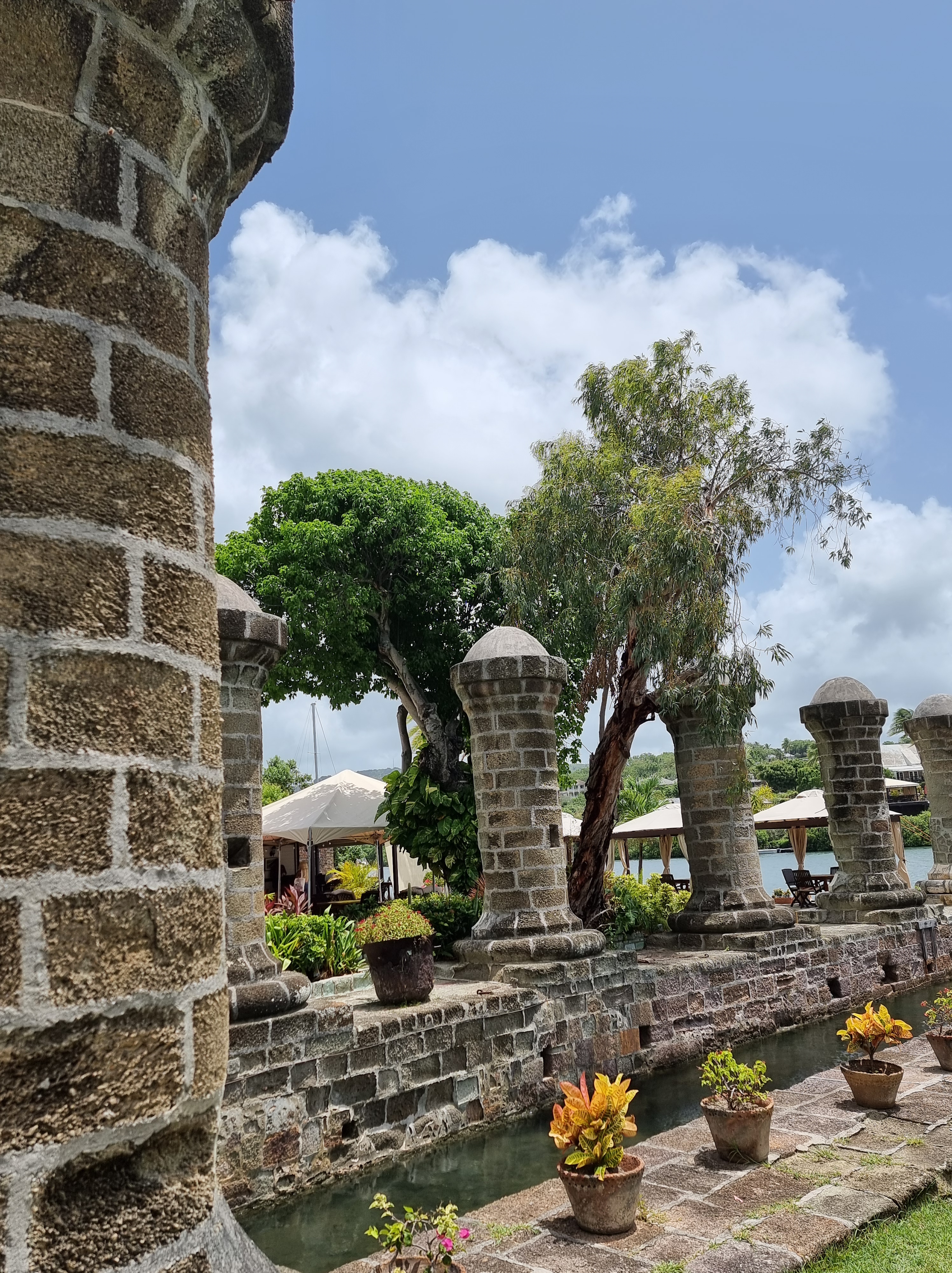
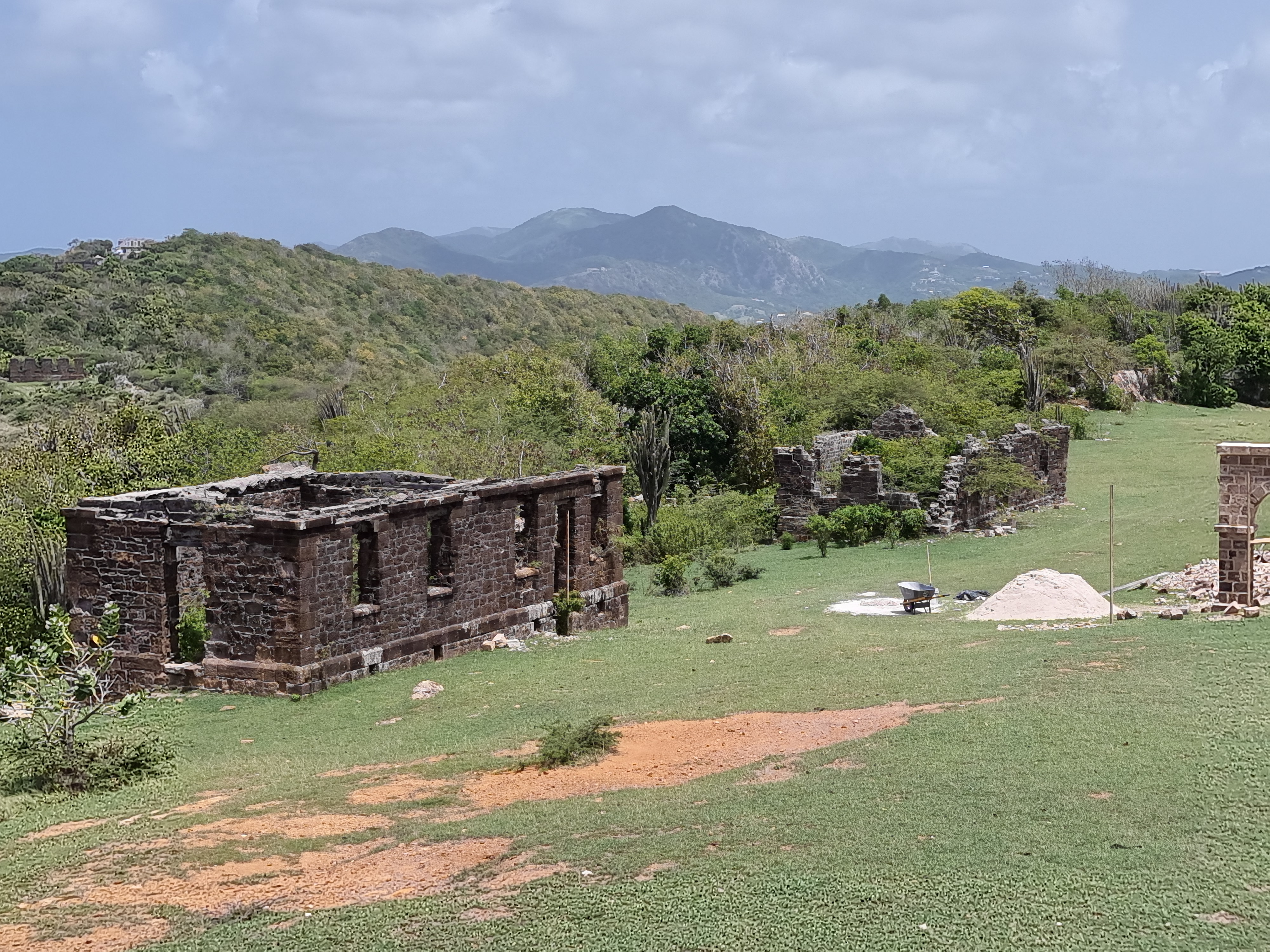
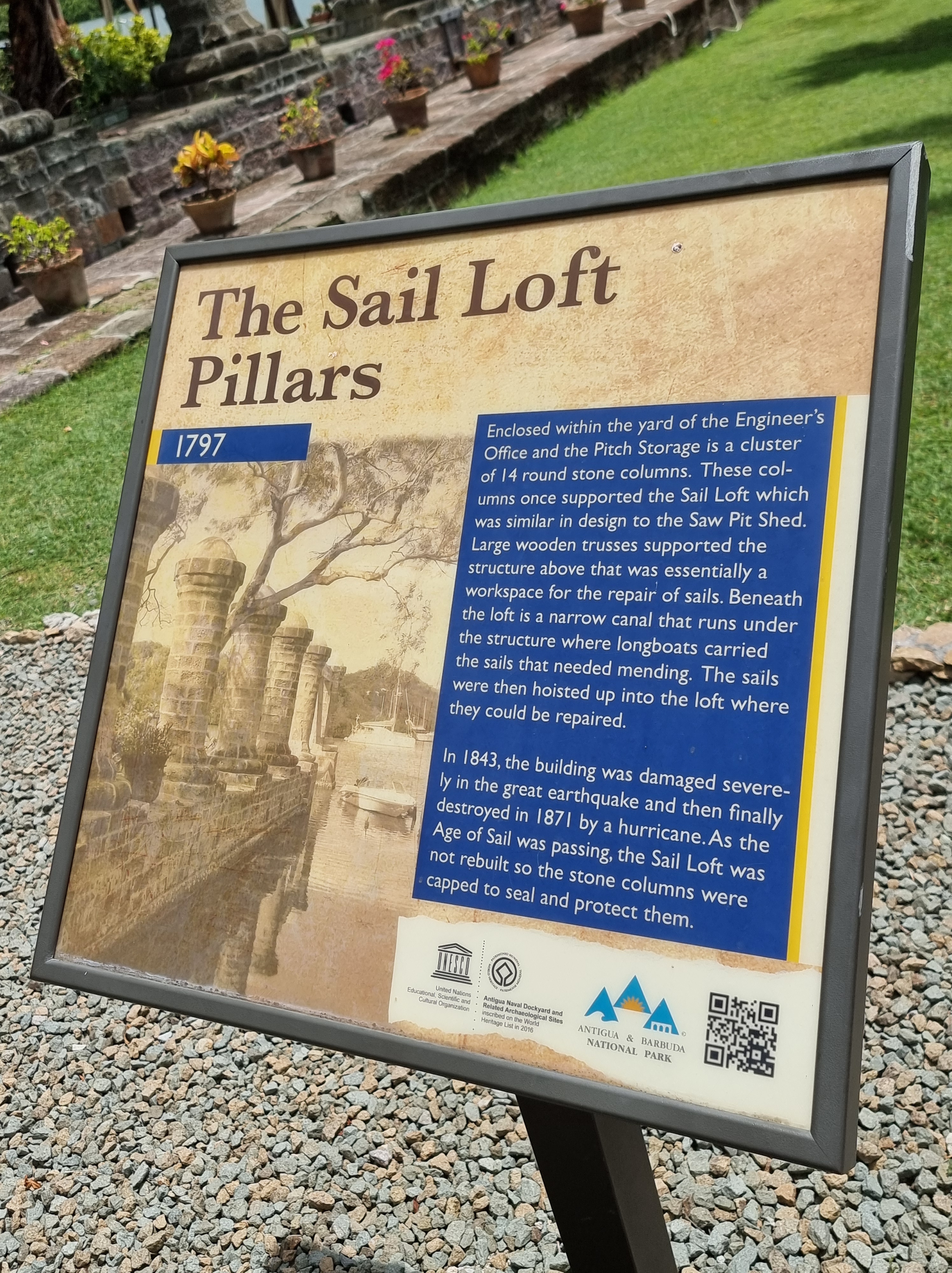
The double row of stone pillars is all that is left of the 1797 boat house and sail loft which was destroyed in an earthquake in 1871. Beyond the pillars is the pitch store and engineer’s offices building.
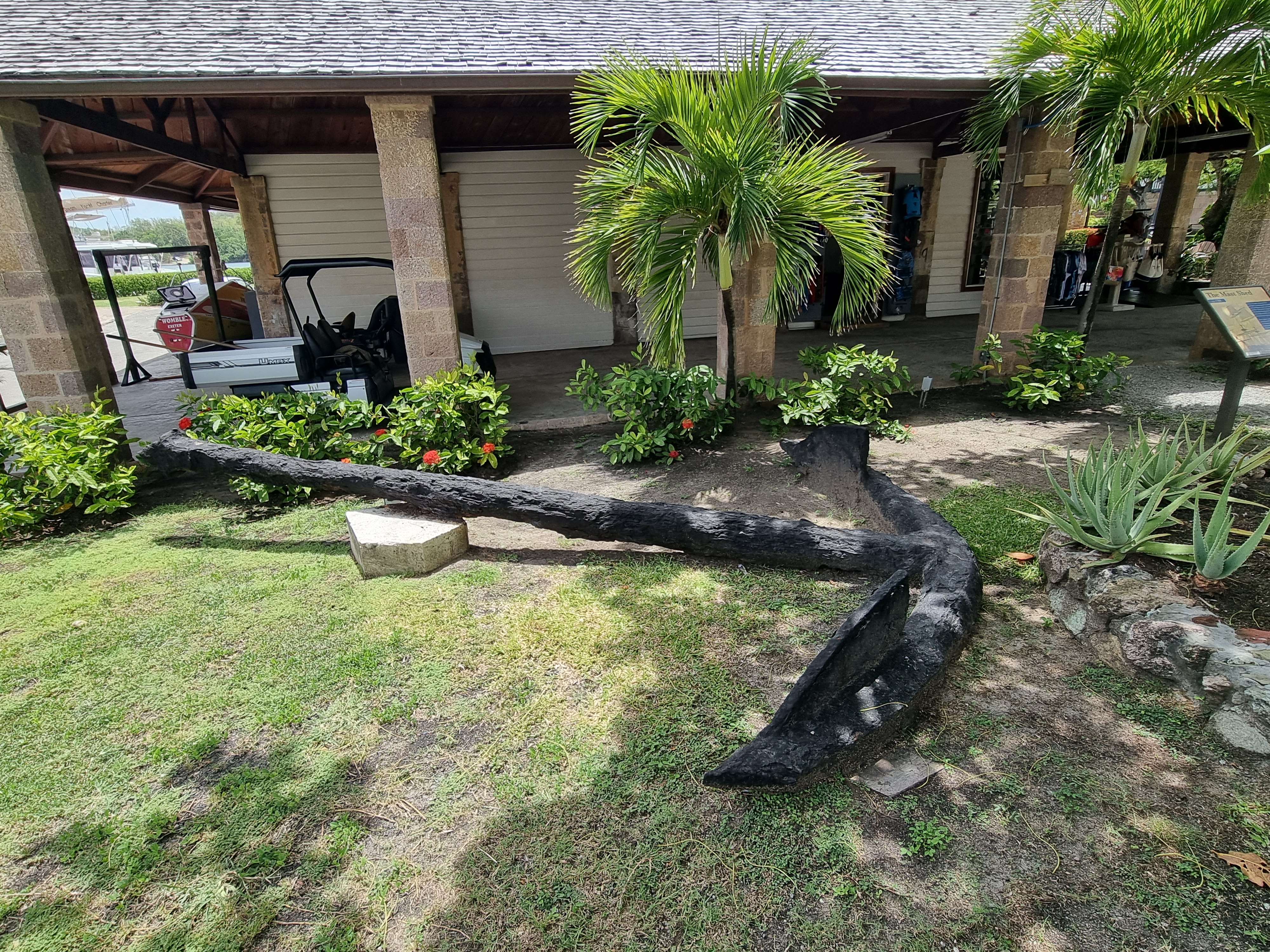
Beyond the nearest figurehead is a 7000 lb anchor and a derelict storehouse with the roof supported on stone pillars. The wooden building with the damaged roof is the joiner’s loft.
Pigeon’s Point Beach is just a five-minute drive from English Harbour on Antigua’s southeast coast. A beloved destination for both locals and tourists, Pigeon’s Point Beach offers a fantastic snorkelling experience. Don’t forget to bring your mask and fins!
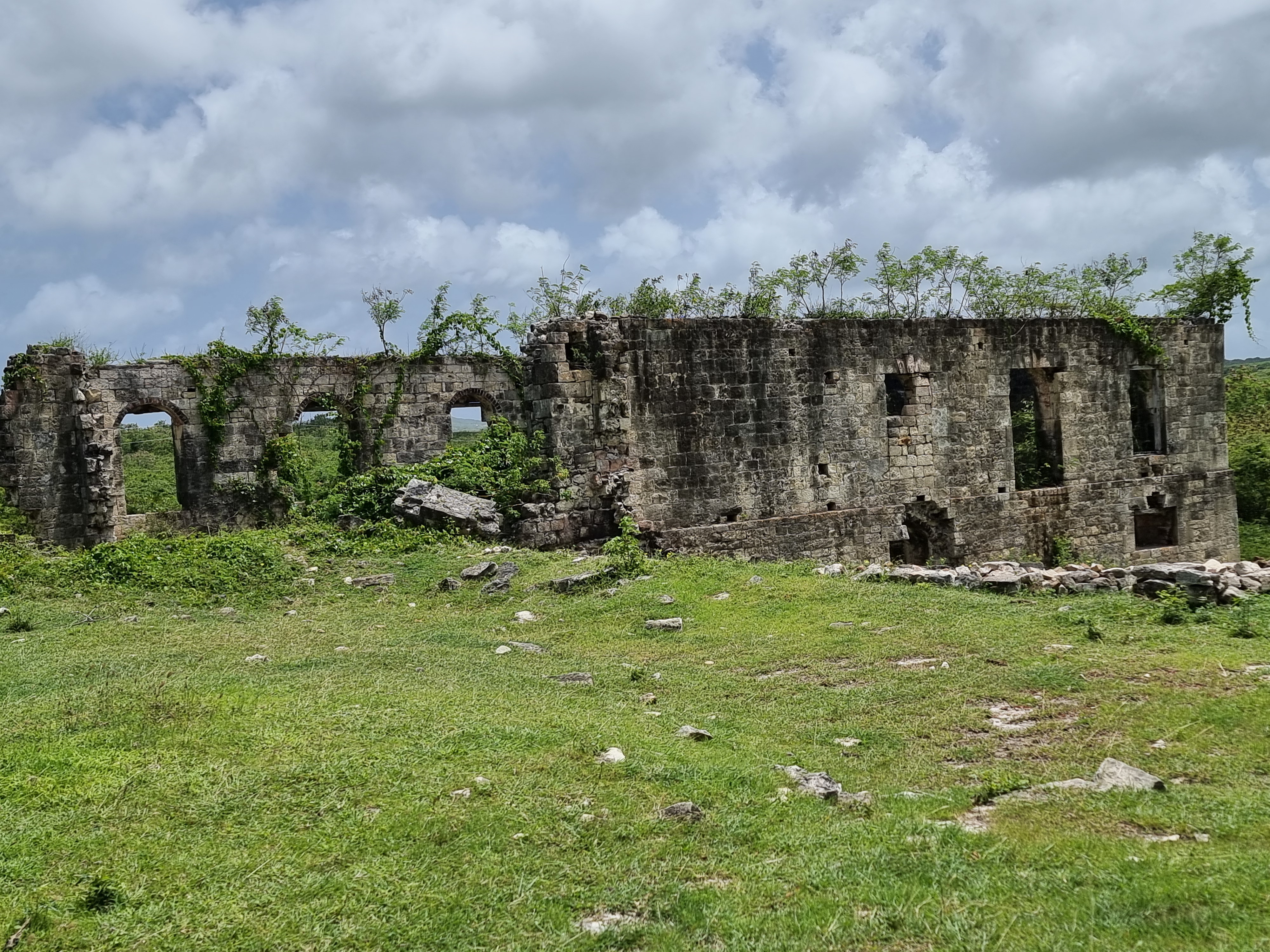
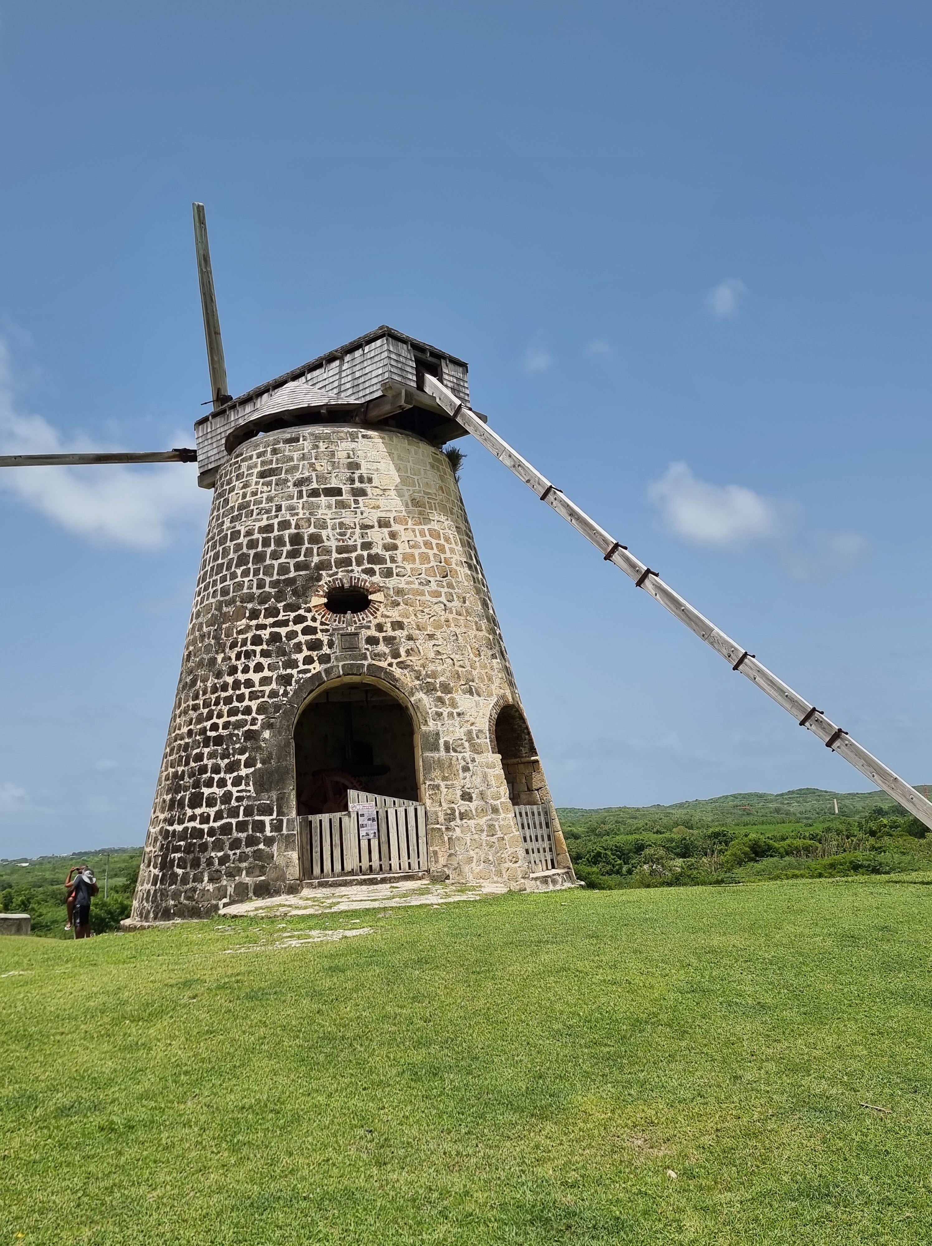
Betty’s Hope
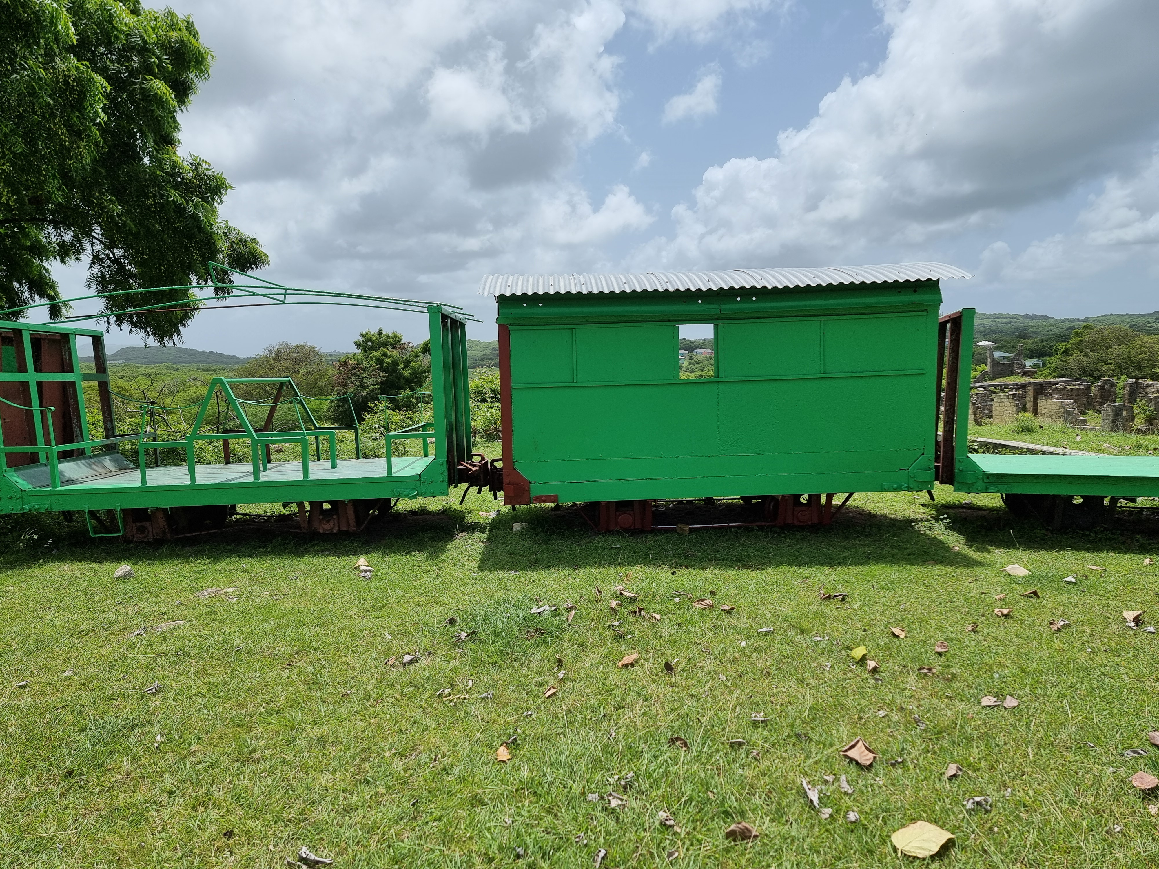
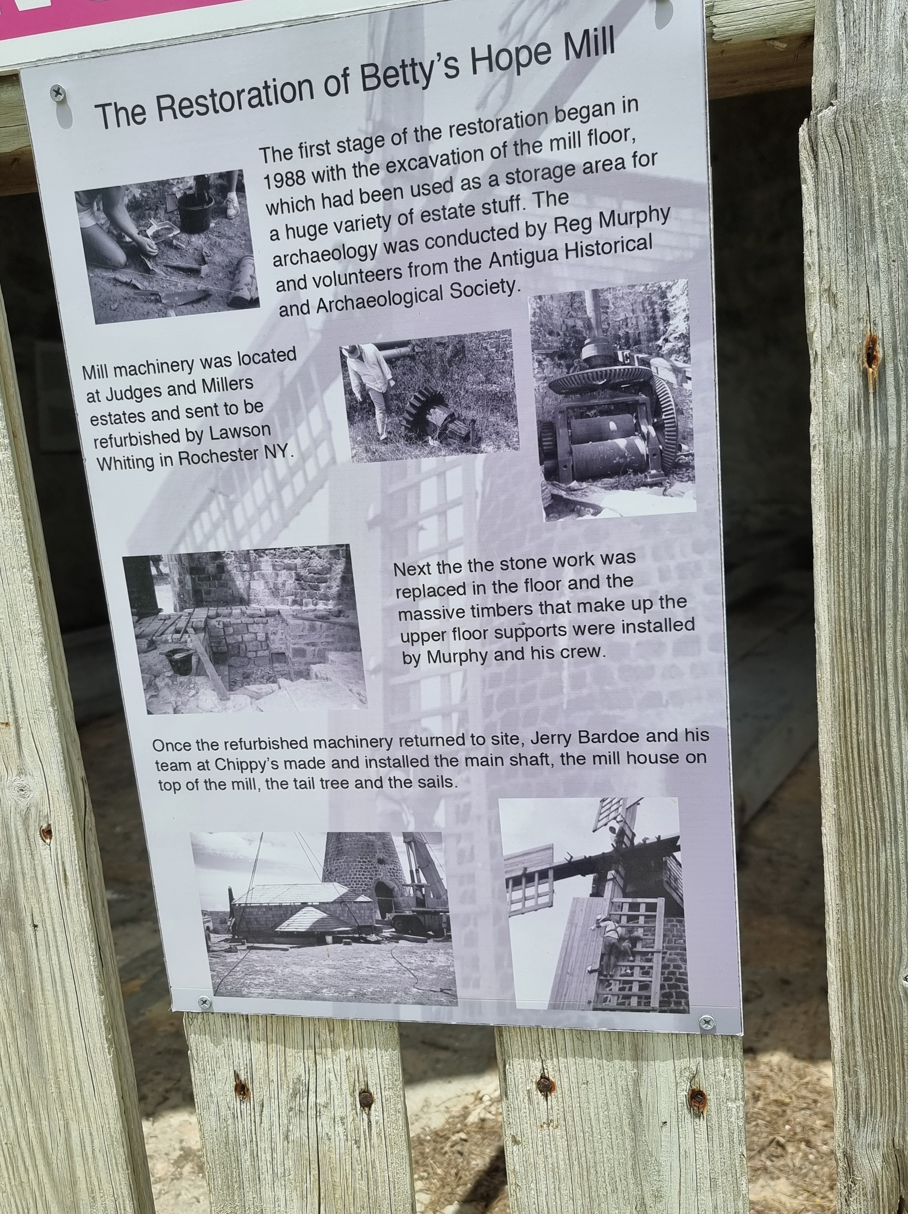
I also visited Betty’s Hope, a historic sugar plantation site on Antigua, where I enjoyed a delightful lunch and spent some time exploring and observing the surroundings. This site features one of its two sugar mill towers fully restored, complete with sails. The small interpretation centre and informative signage scattered throughout the estate provide a deep dive into the plantation’s history, making it a heritage landmark well worth a visit. Dating back to 1651, Betty’s Hope was one of the earliest sugar plantations. It was a large agricultural and industrial enterprise, home to a significant population of people. Supervised by a few European managers, hundreds of individuals of African origin lived and worked on this plantation, initially as slaves and later as laborers after their emancipation in 1834. Despite the gruelling conditions, they developed remarkable skills as craftsmen, boilers, and distillers. The people of Betty’s Hope were particularly renowned for their expertise, a reputation that has endured to this day. Throughout its 300-year history, Betty’s Hope played a significant role in the history of Antigua and Barbuda, influencing the lives of many generations of Antiguans. As I wandered through the estate, I was reminded of my birthplace in Rakiraki, Fiji. Born on a cane farm, I have vivid memories of the cane fields, Penang sugar mill, and the lush green forests surrounding our farms in the small valley area. The visit to Betty’s Hope brought back those nostalgic memories, connecting the past with the present in a truly profound way.

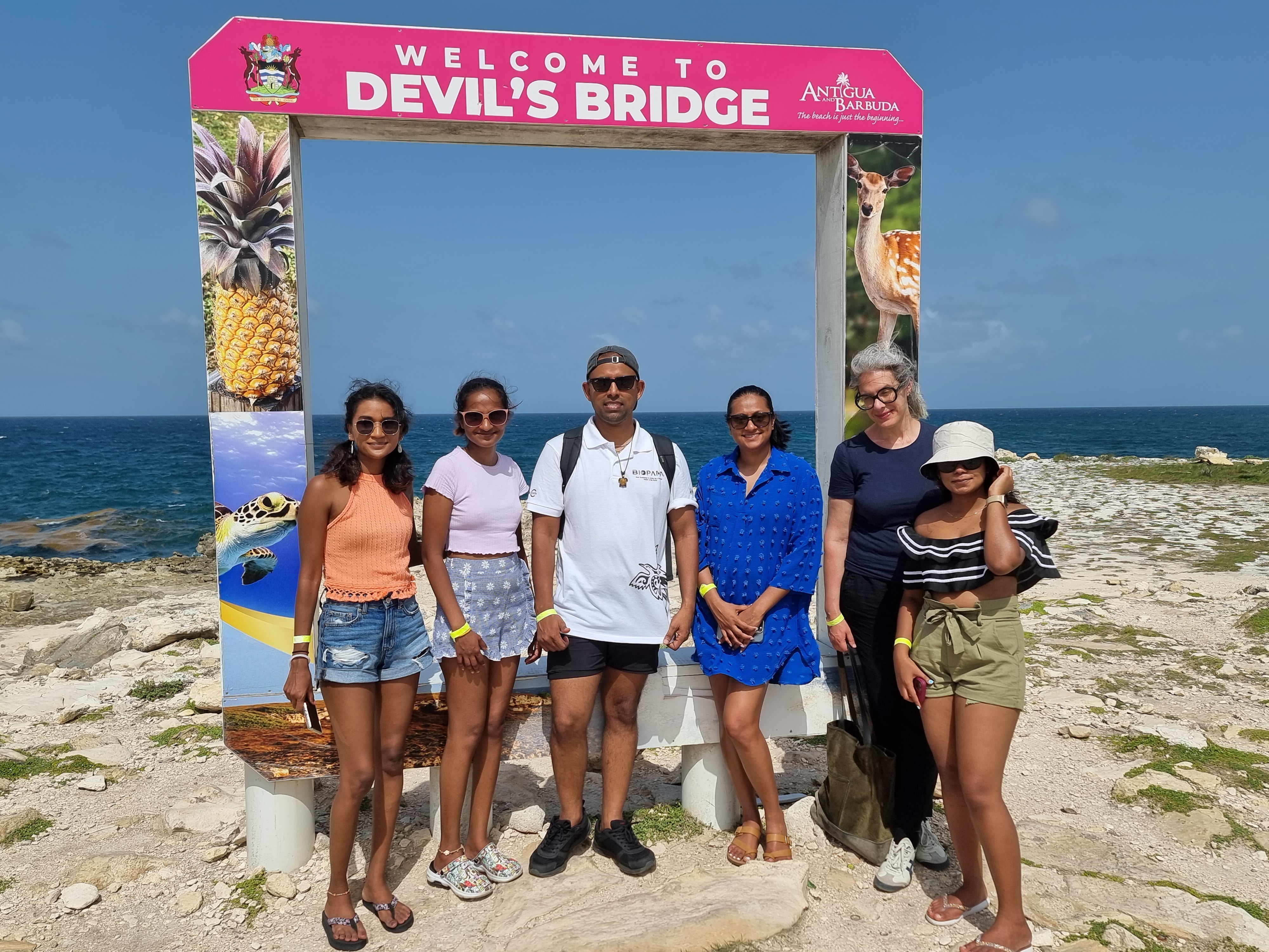
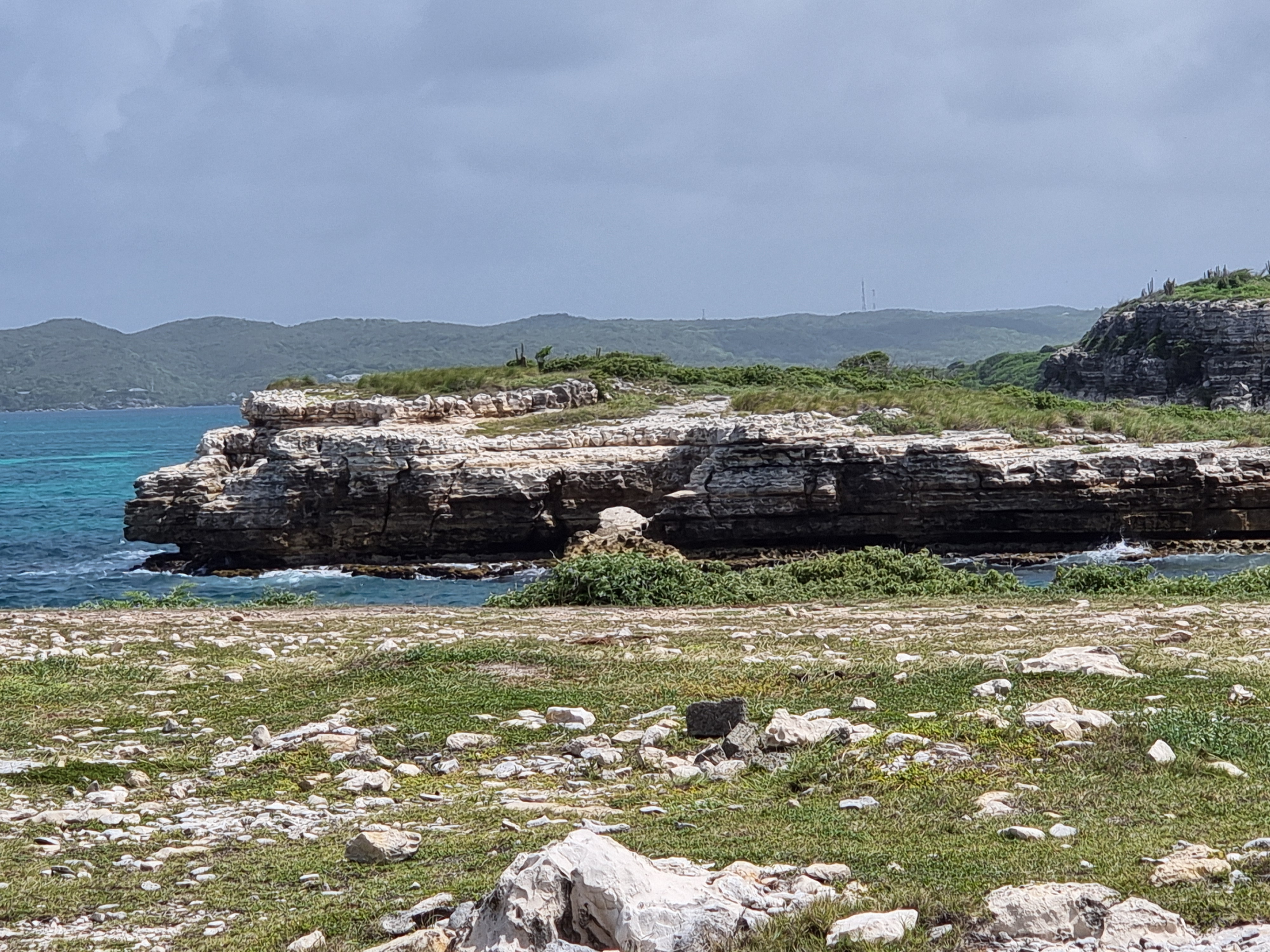
Devils Bridge
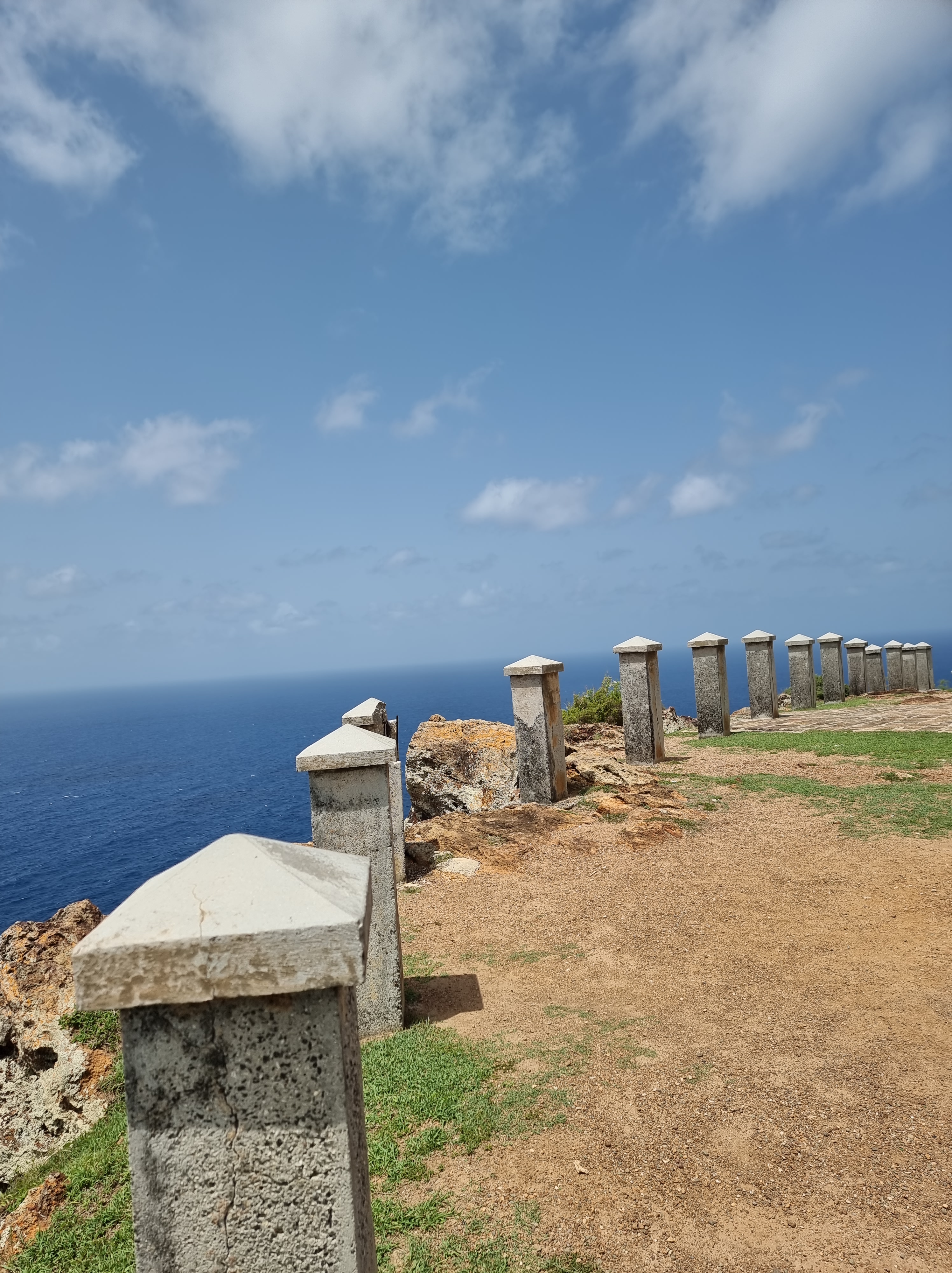
My visit to Devil’s Bridge, located just outside the village of Willikies, was a captivating journey into Antigua’s natural beauty. The site, composed of limestone rock, presents a rugged and awe-inspiring landscape, the result of millions of years of ancient reef formation. As I approached Devil’s Bridge, I was struck by the sheer power and beauty of nature. The Atlantic’s waves have been relentlessly crashing into the east coast of Antigua for hundreds of thousands of years, carving out a natural arch, or bridge, that stands as a testament to the force of the ocean. Walking closer, I could hear the thunderous sound of the waves breaking against the coastal rocks, accompanied by the sight of numerous geysers and blowholes surrounding the arch. The spray of seawater created a refreshing mist that added to the dramatic scene. Standing on the bridge itself was a surreal experience. The contrast between the roaring Atlantic below and the solid, ancient limestone beneath my feet was mesmerizing. I couldn’t help but marvel at how this natural wonder had been sculpted over millennia. Being there, I felt a profound connection to the island’s geological history. The continuous interplay of sea and rock, the sound of the crashing waves, and the sight of the water bursting through the blowholes created an atmosphere of raw, natural power and beauty. It was an experience that left me both humbled and exhilarated, a reminder of the relentless forces of nature that shape our world.
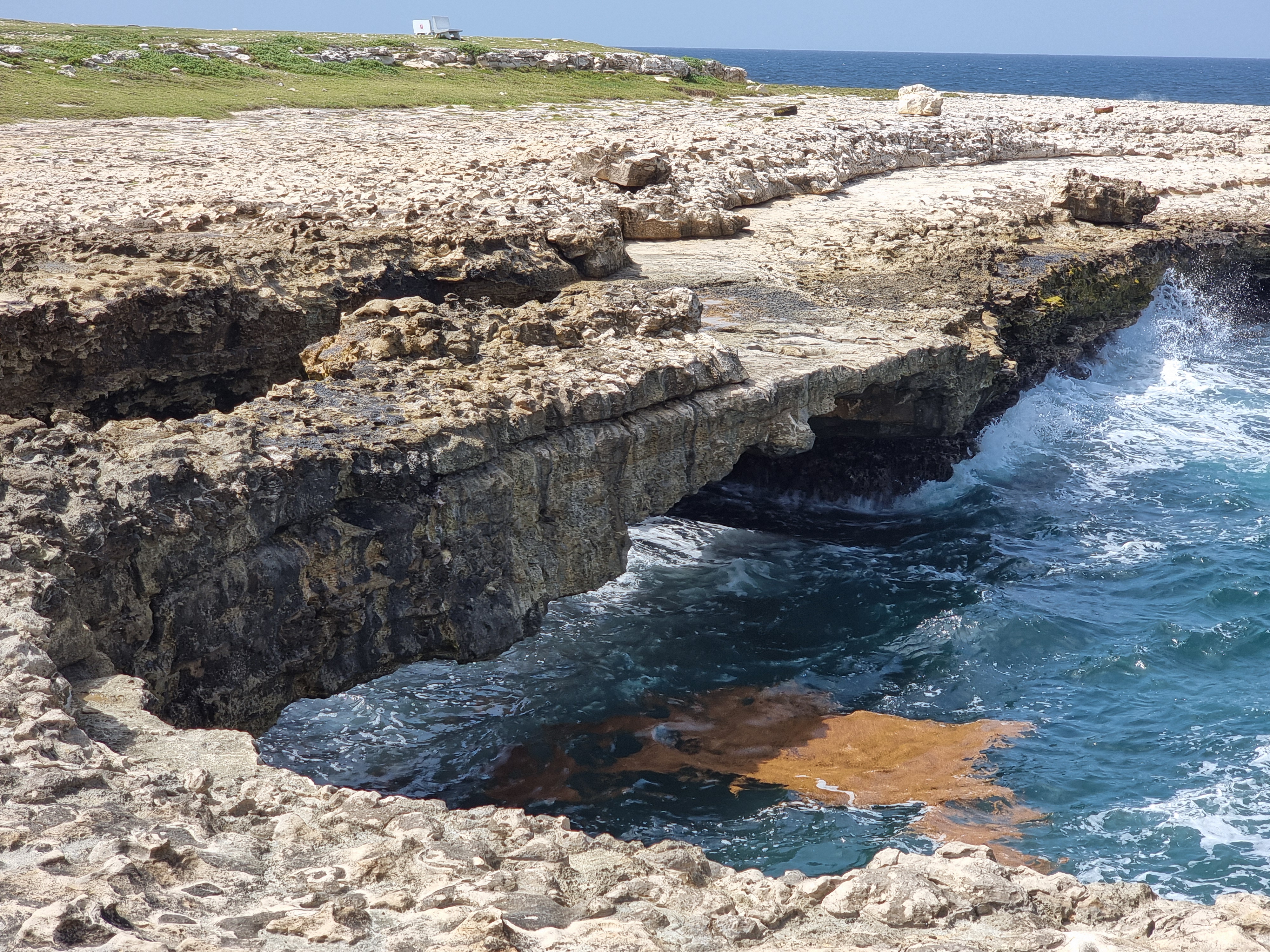
Devil’s Bridge, situated just outside the village of Willikies, provides a breathtaking view of Antigua’s natural landscape. This rugged formation, composed of limestone rock, is the result of millions of years of ancient reef development. For hundreds of thousands of years, the Atlantic waves have relentlessly crashed against Antigua’s east coast, carving out a natural arch, or bridge. Surrounding the arch are numerous geysers and blowholes, created by the continuous assault of the waves on the coastal rocks.